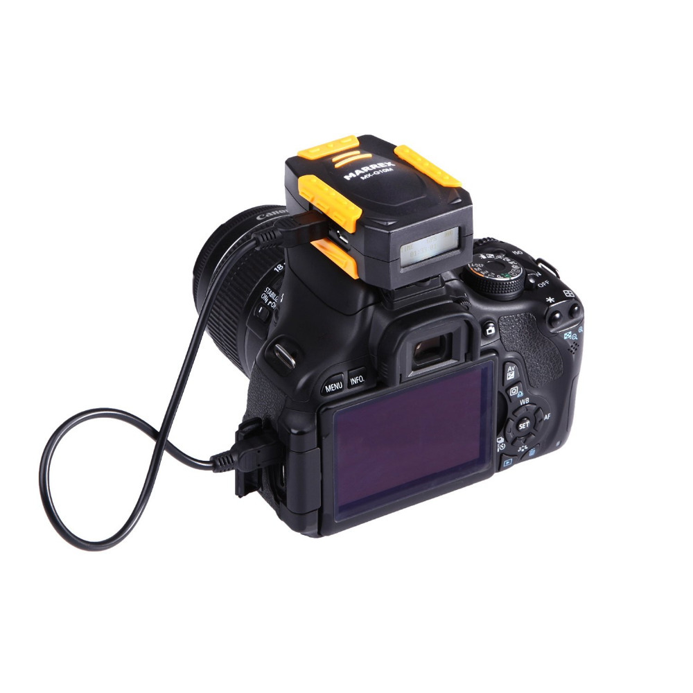

Wholesale Dslr Geotag Adapter Unit Camera GPS Receiver For Canon camera 5D2 1DX 5D3 6D 7D 60D 70D 600D 700D 650D 5D MARK II III
| 45 days Money back Returns accepted if product not as described, buyer pays return shipping; or keep the product & agree refund with seller. | |
|
On-time Delivery Guarantees: On-time Delivery 60 days |
Most Popular from Category
Dslr Geotag Adapter Unit Camera GPS Receiver For Canon Camera 1DX 5D3 6D 7D 70D 700D 650D 5D MARK III
We are the owner of the brand MARREX,if you want to be our dealer,please contact us.
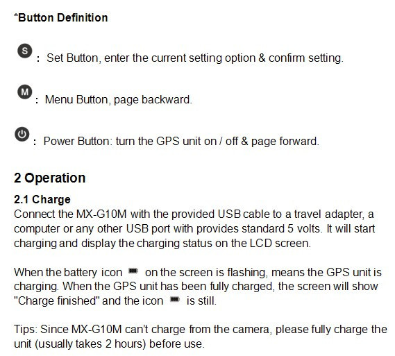
Cautions
- Do not use the unit under water, don’t expose it to rain. Please store it in a cool, dry place.
- Please charge the unit strictly according to related rules. Otherwise, damage might be caused to the battery.
3. Please use and store it in the reference range of temperature. Do not move it from overheated to supercooled condition frequently as well as keep away from heat sources such as heater and oven.
- Be careful to violent collision.
- Please turn off the power when left unused.
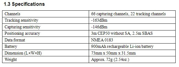
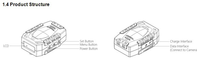
1 PRODUCT INTRODUCTION
1.1General Introductions
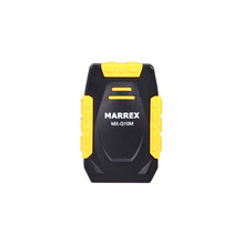
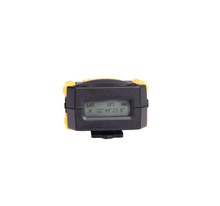
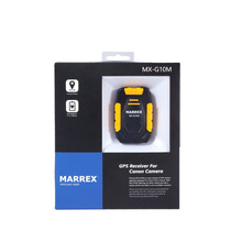
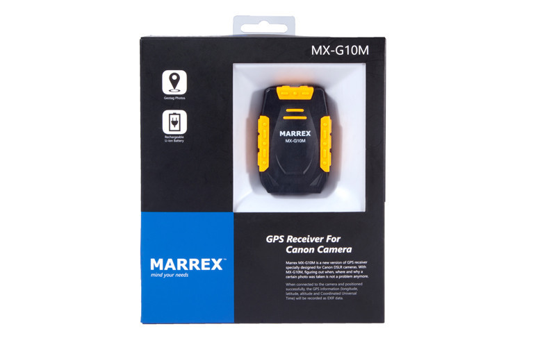
Marrex MX-G10M is a new version of GPS receiver specially designed for Canon DSLR cameras. It is very useful for photographers to organize the stock photos. With MX-G10M, figuring out when, where and why a certain photo was taken is not a problem anymore. When connected to the camera and positioned successfully, the GPS information (longitude, latitude, elevation and Universal Coordination Time) will be recorded as EXIF data.
1.2 Highlights
- LCD screen
GPS information and configuration parameters can be real-time displayed on the high-resolution LCD. The screen can be viewed even under bright sunlight.
- GPS data-hold
If the GPS signal is lost, MX-G10M will automatically reuse the last valid GPS information for tagging the current photo. Once the receiver is turned off, the stored GPS data will lost.
- Build-in Li-ion battery
A build-in rechargeable battery can continuously run for up to 6 hours. When connected to a camera, MX-G10M will not charge from camera.
- High precise time
The LCD screen will show the UTC time once MX-G10M found satellites. You can get the local time by setting an appropriate time zone.
- Fast acquisition
Highly sensitive antenna and upgraded GPS chipset accelerate the satellite searching speed.
In good weather and open sky, cold start 60s, warm start15s and hot start 1s.
2.3 Setup Guide
2.3.1
Turn the camera off.
2.3.2
Press the Power button for more than 3 seconds to turn on the GPS receiver.
2.3.3
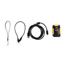
Mount the MX-G10M to the camera’s hot shoe, or secure it to your camera’s neck strap or neck strap lug with the supplied strap, leaving the shoe free for use with a flash or other device.
2.3.4
Connect the GPS unit and DSLR camera with a supplied data cable. When inserting the cable, be sure that the end is oriented correctly and do not use force.
2.3.5
Turn on your camera and the “GPS” icon on the upper right of LCD screen will blink, indicating that it is searching for satellites. When a steady satellite signal is captured, the “GPS” icon will stop blinking.
It takes about 60 seconds to start the receiver up when cold, 15 seconds if you just shut it down, and 1 second to wake up the LCD screen. For successful positioning, you must be outdoors with good weather and open sky.
2.3.7
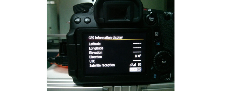
Viewing geotag information.
- Select “GPS device settings”
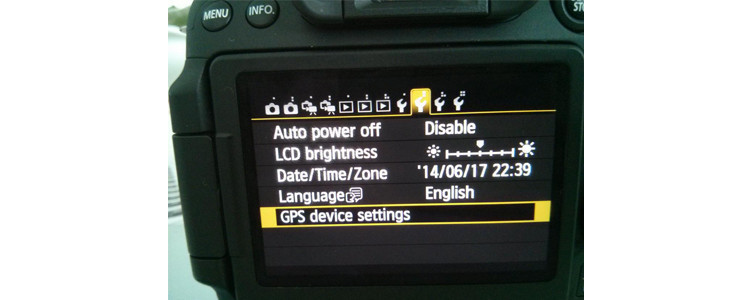
- Select “GPS information display
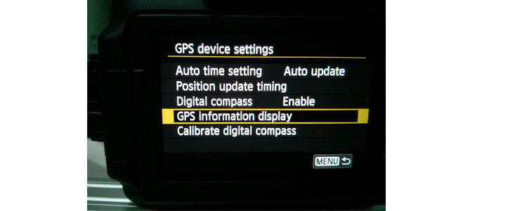
- The detailed GPS information is displayed
2.3.8
You could start shooting and view the geotag information of each photo on the camera’s LCD. 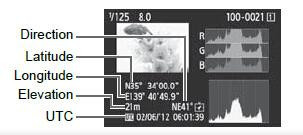
2.3.9
Geotag information can be viewed on PC when images are uploaded to photo sharing sites like Flickr, or opened in imaging software, such as Picasa, ACDsee, GEOsetter, Opanda EXIF, Lightroom, FSviewer.
0 out of 5 (0 Ratings)
| Positive (0%) |
5 Stars (0)
|
|
4 Stars (0)
|
|
| Neutral (0%) |
3 Stars (0)
|
| Neutral (0%) |
2 Stars (0)
|
|
1 Star (0)
|
| Name | Rating | Feedback |
|---|
| Shipping Company | Shipping Cost | Estimated Delivery Time |
|---|---|---|
| 3 - 7 days | ||
| 3 - 7 days | ||
| 5 - 14 days | ||
| Post Air Mail | Free Shipping | 15 - 45 days |
| Return Policy | If the product you receive is not as described or low quality, the seller promises that you may return it before order completion (when you click "Confirm Order Received" or exceed confirmation timeframe) and receive a full refund. The return shipping fee will be paid by you. Or, you can choose to keep the product and agree the refund amount directly with the seller. N.B.: If the seller provides the "Longer Protection" service on this product, you may ask for refund up to 15 days after order completion. |
|---|---|
| Seller Service | On-time DeliveryIf you do not receive your purchase within 60 days, you can ask for a full refund before order completion (when you click "Confirm Order Received" or exceed confirmation timeframe). |
Most Popular from Category
Newest Black Bag For Gopro Hero Accessory Accessories Parts ST-52
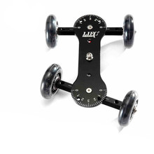
adjustable turn Skater wheel Camera Truck with Mini ball Camera &Photo Studio Accessories Dolly for camera Video DSLR For canon
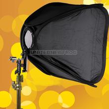
UN2F 80x80cm Easy Foldable Flash Studio Soft Box for Camera Photo Speedlite
Photo Studio Accessories 10pcs Pink Monopole with adapter for Camera Photo
Camera Twin E27 screw Lamp Bulb Holder Photography Slave Flash Umbrella Bracket Photo Studio Accessories
2014 New Brand Bracket For Camera/Convenient Camcorder Stabilizing Handle/Portable Photo Studio Accessories
US $16.28 / piece
online shopping, buying directly from manufacturers?
- Go to Alibaba.com and enter the wanted item into search field.
- Having made your choice, click "Contact supplier" button on the right
- On the next page enter your request and click "Send" button.
- Upon clicking you will be asked to get registered. Do it and wait for the reply.
 ▼
▼